
From the Keys to the Moon: Five Florida Engineering Projects That Have Shaped America
Sunrise on Florida’s First Coast, Amelia Island. Photo Credit: Joe VanHoose
As the United States of America celebrates its 250th anniversary this July, Floridians should take a moment to recognize the engineering projects that shaped our state and the nation.
From expanding access to remote islands to launching astronauts on missions to the Moon, Florida engineers have designed and built projects that have advanced transportation, strengthened national security, fueled economic growth and expanded our reach beyond Earth. These five projects showcase just a few of the ways Florida engineering has helped write the American story.
NASA Mobile Launcher
Since Kennedy Space Center was established in 1962, NASA’s Mobile Launcher (ML) has launched the Apollo rockets to the moon, the Space Shuttle and now the Space Launch System (SLS) rocket and Orion spacecraft on NASA’s Artemis missions to the Moon and Mars.
Apollo 10 launched from the Mobile Launcher in May 1969. The launcher was used five times before being modified for the Space Shuttle program, where it launched 51 Space Shuttle missions starting in 1981.
After the Shuttle program ended, the Mobile Launcher was reimagined and redesigned again. The new launcher is designed to support the assembly, testing, checkout and servicing of the Space Launch System (SLS) rocket, as well as the transfer of the SLS and Orion to the launch pad.
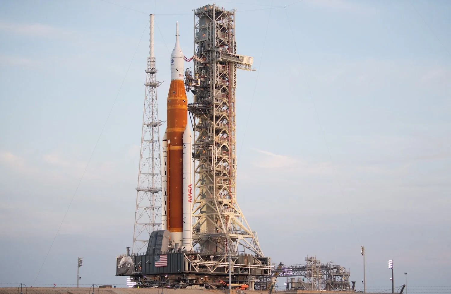
NASA’s Space Launch System (SLS) rocket with the Orion spacecraft aboard is seen atop the Mobile Launcher as it is rolled up the ramp at Launch Pad 39B at Kennedy Space Center. Image Credit: NASA/Joel Kowsky
NASA's Exploration Ground Systems (EGS) modified the 370-foot-tall, 11 million-pound steel structure. J.P Donovan Construction installed and integrated ground support equipment systems onto the Mobile Launcher. RS&H completed the majority of the structural design and facility design modifications.
During preparations for launch, the crawler-transporter picks up and moves the Mobile Launcher into High Bay 3 in the Vehicle Assembly Building (VAB). The Mobile Launcher is structurally supported at the VAB and launch pad atop support posts, called mount mechanisms. The Crawler Transporter fits within the space above the ground surface and beneath the bottom of the Mobile Launcher to lift and lower it onto the mount mechanisms before and after transportation.
With its usefulness stretching back more than 50 years, NASA’s Mobile Launcher will continue to propel America’s space program forward and deeper into space than ever before.
Fort Jefferson & The Dry Tortugas
Located on Garden Key within the Dry Tortugas, Fort Jefferson was designed by Chief Engineer Joseph Totten and built by the Army Corps of Engineers to protect the shipping lines between New Orleans and ports along the East Coast, as well as to ensure the United States’ claim of the land. Additionally, a deep basin between Garden Key and Loggerhead Key made the area ideal for military ships to anchor and resupply.
“The idea was to build a fortification to protect the shipping lines, but also to supply these Navy ships so they didn’t have to travel all the way back to the mainland to get supplies,” said Brad Bertelli, author and Florida Keys historian.
Fort Jefferson was built as an elongated hexagon, with four sides measuring 77 feet and two sides measuring 325 feet, and surrounded by a 70-foot-wide moat. The fort’s 45-foot-tall walls encompass 11 of the 16 acres of land on Garden Key.
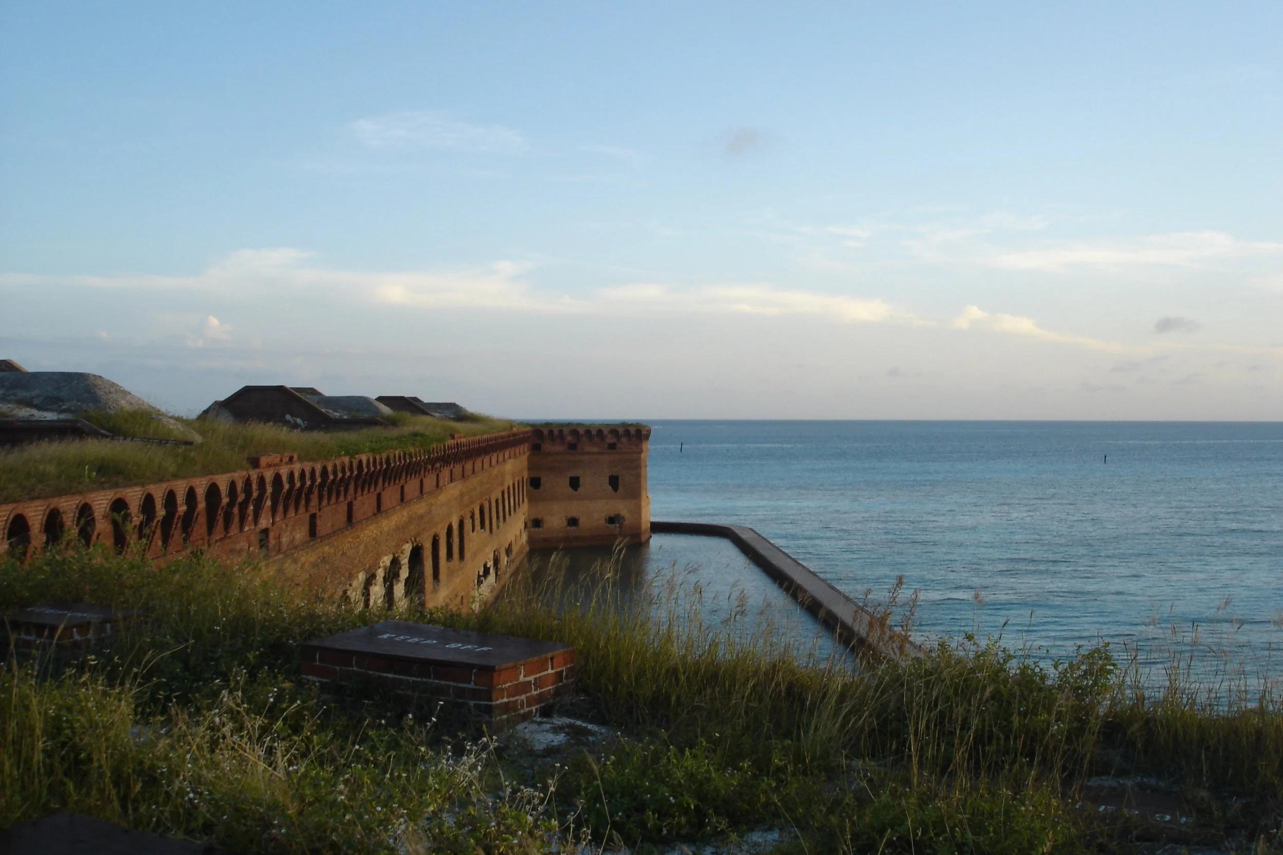
A view of Fort Jefferson’s moat and walls from at elevated terreplain around the fort. Image Credit: National Park Service
Approximately 16 million bricks were used in the fort’s construction, making Fort Jefferson the largest brick structure in North America. The structure includes more than 2,000 brick arches and was designed to hold a garrison of 1,500 soldiers.
Because freshwater access was critical in the Dry Tortugas, Fort Jefferson was built with more than 100 cisterns beneath it capable of holding 1.5 million gallons of water. Additional cisterns were constructed on the parade grounds inside that could hold 92,000 gallons of water.
President Franklin D. Roosevelt designated Fort Jefferson a national monument in 1935, and it remains a tourist destination as part of Dry Tortugas National Park to this day.
Seven Mile Bridge
At the time of its completion in 1982, Seven Mile Bridge in the Florida Keys was the longest continuous concrete segmental bridge in the world. The bridge’s 264 spans carry the Overseas Highway from Marathon to the Lower Keys.
The new bridge replaced the original Seven Mile Bridge that first served Henry Flagler’s Over-Sea Railroad before being converted for automobile traffic on the Overseas Highway and being dubbed the “Eighth Wonder of the World.” Much of the Over-Sea Railroad was destroyed during the tragic Labor Day Hurricane of 1935, but remnants of the structure were sold to the State of Florida and used in the construction of the Overseas Highway.
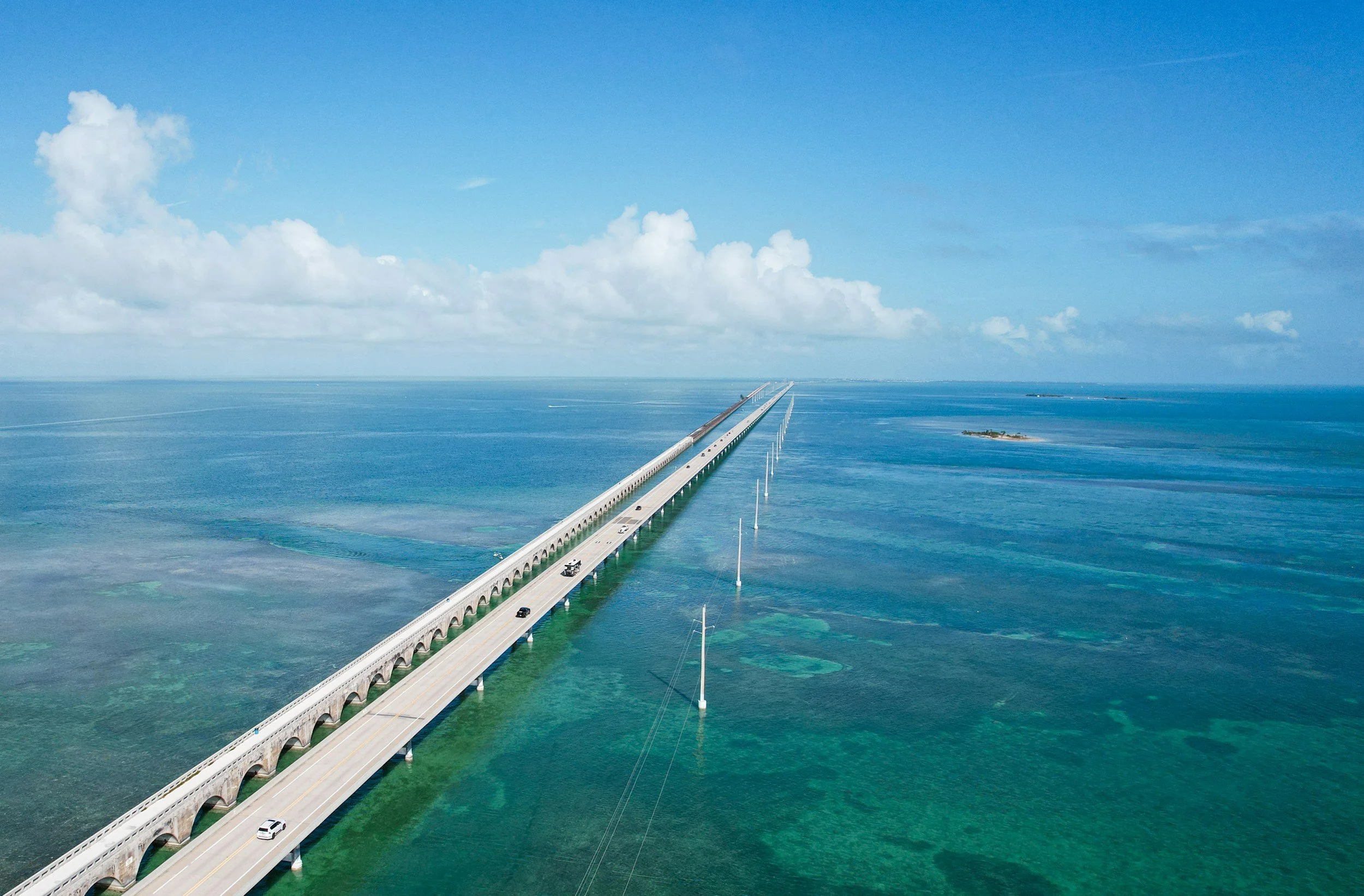
The modern Seven Mile Bridge runs parallel to the original bridge, which is now used by pedestrians. Image Credit: Zoshua Colah
The Overseas Highway and Seven Mile Bridge changed the Florida Keys from a culture reliant on boats to bring people, goods and mail to the islands and shifted communities from the edges of the islands to the right-of-way.
The newer Seven Mile Bridge is a box-girder structure built from precast, prestressed concrete sections, comprising 440 spans. Designed by Figg & Muller Engineers, the bridge rises in an arc near its center to provide 65-foot-high clearance for boat passage. It utilizes a precast, post-tensioned box girder superstructure and hollow precast segmental piers, which increased the speed of construction.
The structure was completed six months ahead of schedule and has earned eight awards, including an Exceptional Award for Cost Savings Innovation from the Federal Highway Administration.
The total length of the new bridge is actually 6.79 miles long – a bit shorter than Flagler’s original structure, strands of which still run parallel to the new bridge and serve pedestrians and cyclists.
State Road A1A
More than 100 years ago, Highway A1A began as a narrow brick-paved road built to facilitate the movement of Florida citrus and other exports to more populated cities in the North. Florida’s coastal highway helped open up the state to tourists and became known as the main route heading south for escaping the cold weather during winter.
In 1926, the Florida State Road Department (now FDOT) constructed Highway A1A as we know it, originally named FLA 140, to serve the increasing numbers of tourists coming to Florida to enjoy its east coast beaches. The Department changed the name of the road to State Road 1 in 1945 before renaming it again to A1A in 1946 to avoid confusion with nearby U.S. 1.
Today, A1A stretches more than 300 miles from Key West to Fernandina Beach, traveled by millions of people annually. In the 1960s, the Fort Lauderdale stretch of A1A became the epicenter of the Spring Break phenomenon, and those college crowds moved north on the road to Daytona Beach by the 1970s and ‘80s.
In 2021, the Federal Highway Administration awarded the 72-mile corridor between St. Johns and Flagler counties the highest national classification as an All-American Road.
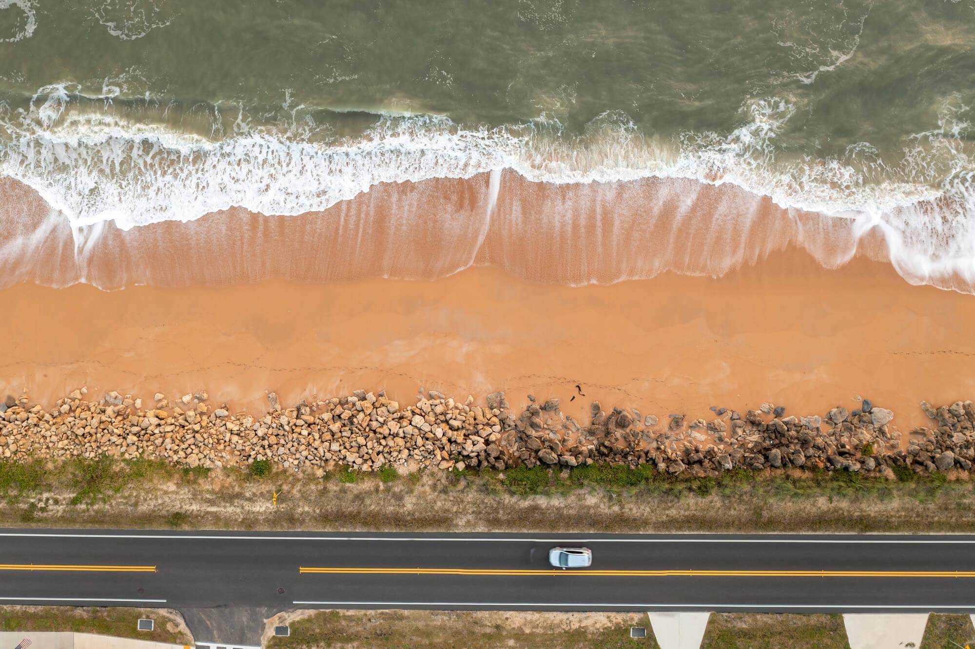
A1A along Flagler Beach. Photo Credit: FDOT/Florida Scenic Highways
Daytona International Speedway
Racing history on Daytona Beach and neighboring Ormond Beach stretches back to the early 1900s, as racers from across the world brought their cars to the hard-packed sand to try and set new world records. One-mile speed runs eventually turned into stock car races on a four-mile course that used the beach and a two-lane stretch of A1A.
Famous racing promoter and NASCAR founder Bill France formed a partnership with Charles Moneypenny, Daytona Beach’s city engineer, who put France’s ideas to paper to create NASCAR’s most famous racetrack, the Daytona International Speedway.
France wanted a 2.5-mile high-banked track that would be the same size as Indianapolis Motor Speedway – but faster. Moneypenny found a patch of land between Daytona’s airport and dog track and created the unique “tri-oval” design to ensure the track fit on the property.
The 50-foot-wide Daytona racing surface features turns banked at 31 degrees – as steep as pavers could lay down the asphalt, France told the New York Times in 1958. The speedway opened in 1959 with the first Daytona 500 and became an instant success.
Today, Daytona International Speedway is known as the “World Center of Racing.” The racing world still descends on Daytona Beach every winter for Speedweeks, which includes the Rolex 24-hour sports car race, motorcycle racing and, the biggest race in America, the Daytona 500.
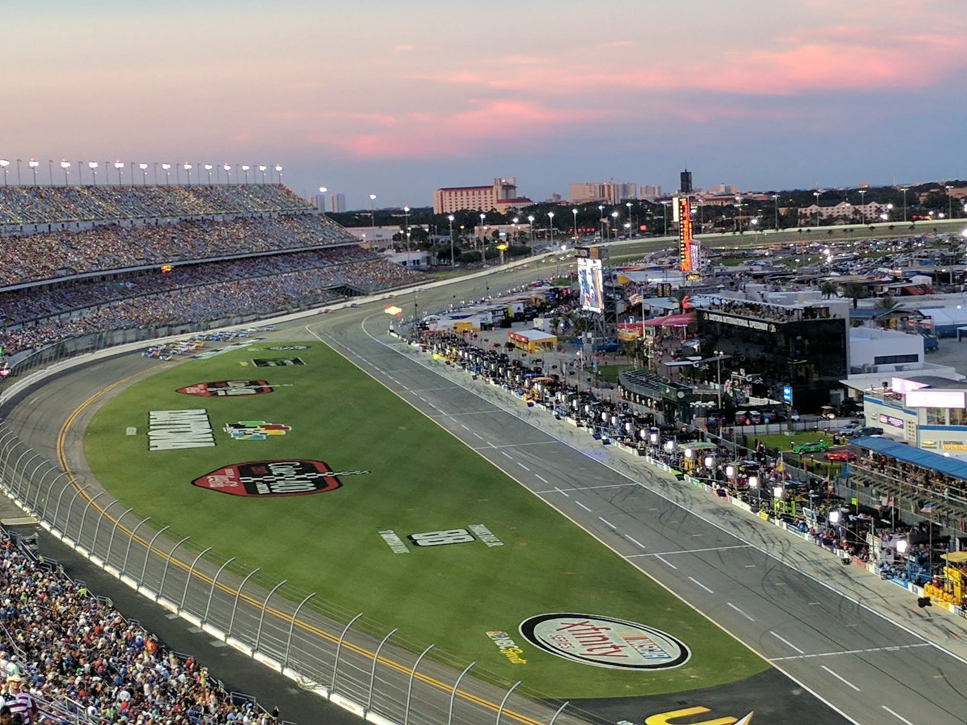
Daytona International Speedway has become known as the World Center of Racing since its opening in 1959. Photo Credit: Joe VanHoose
