
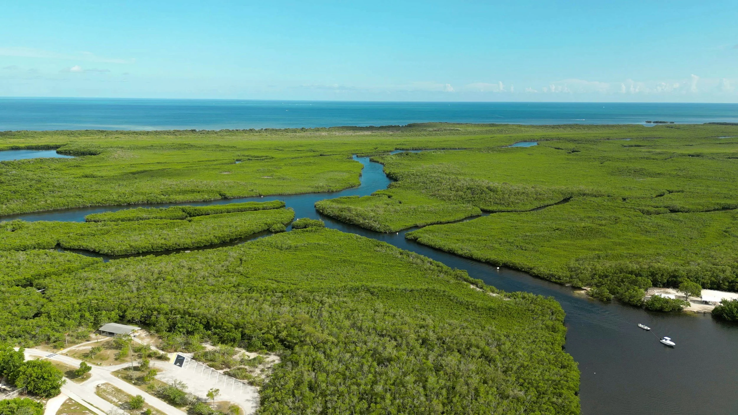
Mangroves can dissipate wave energy, dunes can limit coastal exposure, and wetlands can store and slowly release water during and after storm events. These systems add capacity, attenuation and protection in ways that complement built infrastructure. Photo by Julius Hildebrandt/Unsplash.
Smart city conversations often begin with technology, but that focus changes when disruption spreads across the whole network. At that point, resilience becomes the priority. And resilience depends on how systems work together.
Because a storm does not test one piece of infrastructure. It tests the entire city.
Water does not respect the boundaries cities use to plan, fund and operate infrastructure. In a single event, rainfall, storm surge, groundwater and coastal wave action can load drainage networks, roadways, utilities, pump stations, public facilities and emergency access routes at the same time.
That combined loading is exposing a capacity gap. Systems designed around historic rainfall patterns, lower coastal water levels or isolated design events are being asked to serve growing populations, higher service demands and storms that are increasing in both size and frequency.
The result is not only nuisance flooding or temporary disruptions; it is also a need to upgrade infrastructure so it can manage larger hydraulic loads, maintain critical access, protect coastal edges and continue operating when multiple systems are stressed together.
Resilience depends on designing these interactions deliberately: increasing conveyance and storage where needed, strengthening shorelines where exposure is highest, protecting critical corridors and integrating natural systems that reduce wave energy, attenuate flows and provide room for water before it overwhelms built assets.
Natural systems are part of how cities perform
Infrastructure has traditionally been defined by engineered assets that collect, convey, pump, store or protect against water. Those assets remain essential, particularly where flooding, access loss or service disruption would affect public safety, mobility or critical operations.
What is changing is the definition of system performance. Cities are increasingly looking beyond hard infrastructure alone and considering how natural systems can reduce loads before they reach built assets.
Mangroves can dissipate wave energy, dunes can limit coastal exposure, and wetlands can store and slowly release water during and after storm events. These systems add capacity, attenuation and protection in ways that complement fixed infrastructure rather than replace it.
That makes them part of the infrastructure response. They help manage water volume, reduce erosive forces and create space for water to move without immediately overwhelming drainage, transportation or coastal protection systems.
When natural and engineered assets are planned together, the system has more ways to absorb stress, maintain service and recover after high-water events.
Integration improves system outcomes
Resilience is often framed as a choice between natural systems and engineered infrastructure, but water-related risk rarely behaves that neatly.
During coastal storms, high tides, heavy rainfall or surge events, infrastructure performance depends on how hydraulic, coastal and geotechnical systems interact across the full shoreline and drainage network.
A seawall can protect a critical asset or corridor, but it can also change wave reflection, overtopping patterns and shoreline response. A dune system can reduce the energy reaching that structure, while offshore features can influence sediment movement and the way storm forces are distributed along the coast.
Each intervention changes the load path, failure mode and recovery profile of the wider system.
Stronger outcomes come from designing those interactions deliberately. Natural systems can attenuate water levels, reduce wave energy and maintain sediment processes, while engineered assets provide defined protection where access, utilities, public safety or critical operations cannot tolerate disruption.
Integrated planning gives the system more capacity to absorb stress, limit cascading impacts and adapt as coastal conditions and storm demands continue to change.
Resilience develops over time
Resilience is often treated as if it requires one large capital investment, but that framing can delay the near-term actions that reduce risk and preserve future options. There are key approaches to long term planning and execution of near term improvements while monitoring trigger points for future risk and action.
Municipalities do not need to design for every future condition in a single project. Sea level rise, groundwater change, rainfall intensity and coastal exposure develop over different time horizons, and infrastructure can be planned to respond as those thresholds are reached.
That means designing assets with expansion capacity, identifying trigger points for additional investment and avoiding premature replacement by planning how systems can be adapted over time.
Early action creates flexibility before service thresholds, construction constraints or funding pressures narrow the available choices. Planning and evaluation are invaluable early steps that can decide an informed decision-making matrix for decades.
Planning creates long-term value
The most important resilience decisions are often made before decision-making construction funding is committed.
Understanding how water moves through a watershed, how shorelines respond to changing conditions and how infrastructure performs when multiple systems are stressed together provides the basis for better sequencing, prioritization and investment decisions.
That technical understanding is especially important for cities facing water-related risk, including water-stressed environments where supply, reuse, storage and flood resilience are increasingly connected.
In some Gulf Coast regions, for example, long-term monitoring, shoreline analysis and asset condition data are helping define where infrastructure should be reinforced, adapted or phased rather than replaced outright.
Municipalities that invest in this planning are better positioned to manage change with fewer emergency decisions, fewer stranded assets and fewer trade-offs between protection, access and long-term cost.
What this means for the next phase of smart cities
Smart city planning has focused on making infrastructure more connected. The next phase is making those connected systems more resilient under changing water, storm and coastal conditions.
Natural systems bring adaptive capacity that engineered assets alone cannot provide. When integrated with drainage, transportation, utility and coastal protection systems, they help infrastructure respond to uncertainty as part of its operating function.
That shift is gaining momentum as cities recognize that resilience is not a separate planning layer, but a performance requirement for the infrastructure systems they already depend on.
Nature is becoming part of that infrastructure system because it can reduce loading, provide space for water, support coastal stability and improve recovery after high-water events.
As cities rethink how they plan for water risk, resilience and long-term infrastructure performance, this systems-based approach will continue to shape the next generation of smart city investment.
Melissa Burns is Business Group Leader, Maritime and Coastal Engineering at GHD, working with municipalities and coastal communities to plan and deliver infrastructure that responds to flood risk, shoreline change and long-term resilience challenges. She can be reached at melissa.burns@ghd.com.